2025-01-05 19:22:00
A blast of snow, ice, wind and plunging temperatures stirred up dangerous travel conditions in parts of the central U.S. on Sunday, as a disruptive winter storm brought the possibility of the “heaviest snowfall in a decade” to some areas.
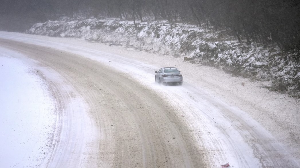
Snow and ice blanketed major roadways in nearly all of Kansas, western Nebraska and parts of Indiana, where the state’s National Guard was activated to help any motorists who were stuck. At least 8 inches of snow were expected, particularly north of Interstate 70, as the National Weather Service issued winter storm warnings for Kansas and Missouri, where blizzard conditions were reported. The warning extended to New Jersey for Monday and into early Tuesday.
“For locations in this region that receive the highest snow totals, it may be the heaviest snowfall in at least a decade,” the weather service said early Sunday.
About 63 million people in the U.S. were under some kind of winter weather advisory, watch or warning on Sunday, according to Bob Oravec with the National Weather Service.
The polar vortex of ultra-cold air usually spins around the North Pole. People in the U.S., Europe and Asia experience its intense cold when the vortex escapes and stretches south.
Studies show a fast-warming Arctic is partly to blame for the increasing frequency of the polar vortex extending its icy grip.
Snow and ice in the forecast
In Indiana, snow fully covered portions of Interstate 64, Interstate 69 and U.S. Route 41, prompting Indiana State Police to plead with motorists to stay off the roads as plows worked to keep up with the pace of the precipitation.
“It’s snowing so hard, the snow plows go through and then within a half hour the roadways are completely covered again,” Sgt. Todd Ringle said.
Part of I-70 was closed in central Kansas by Saturday afternoon. Roughly 10 inches (25 centimeters) of snow had fallen in parts of the state, with snow and sleet totals predicted to top 14 inches for parts of Kansas and northern Missouri.
Parts of upstate New York saw 3 feet (0.9 meters) or more of snow from a lake effect event expected to last until late Sunday afternoon.
The storm was then forecast to move into the Ohio Valley and reach the Mid-Atlantic states on Sunday and Monday, with a hard freeze expected as far south as Florida.
Car wrecks start as storm hits
The National Weather Service warned that travel in numerous states, including Kansas and Missouri, could be “very difficult to impossible.”
Indiana State Police reported a handful of spinouts and crashes Sunday.
A day earlier, a fire truck, several tractor-trailers and passenger vehicles overturned west of Salina. Rigs also jackknifed and went into ditches, state Highway Patrol Trooper Ben Gardner said. He posted a video showing his boots sliding across the highway blacktop like he was on ice skates. He begged people to stay off the roads.
Governors in neighbouring Missouri and nearby Arkansas declared states of emergency.
Air and rail travel also snarled
The storms also caused havoc for the nation’s railways, leading to numerous cancellations. More than 20 cancellations were planned on Sunday, 40 for Monday and at least two for Tuesday.
“If local authorities are telling people not to travel, it’s counterintuitive to try to run a full slate of services when people are being told to stay home,” Amtrak spokesperson Marc Magliari said. “Likewise, we know our people are going to have trouble getting in to work.”
The Midwest was hit especially hard. A train between Chicago and New York and several regional trains between Chicago and St. Louis were among those cancelled Sunday.
Nearly 200 flights in and out of St. Louis Lambert International Airport were cancelled, according to tracking platform FlightAware.
Temperatures dip, though no records break
Starting Monday, the eastern two-thirds of the country will experience dangerous, bone-chilling cold and wind chills, forecasters said. Temperatures could be 12 to 25 degrees (7 to 14 degrees Celsius) below normal.
In Chicago on Sunday, temperatures hovered in the teens (minus 7 to 10 Celsius) and around zero in Minneapolis, while dropping to 11 below in International Falls, Minnesota, on the Canadian border.
The Northeastern states are more likely to experience several days of cold following what has mostly been a mild start to winter, said Jon Palmer, a meteorologist with the National Weather Service in Gray, Maine. A plume of cold air coming down from Canada is likely to result in a cold but dry week, he said.
The cold air will likely grip the eastern half of the country as far south as Georgia, Palmer said, with parts of the East Coast experiencing freezing temperatures and lows dipping into the single digits in some areas.
Wind might also pick up as the week gets going, making for potentially dangerous conditions for people exposed to the elements for long periods of time, Palmer said.
Disruptions extend southward
The National Weather Service predicted 8 to 12 inches (about 20 to 30 centimeters) of snow for the Annapolis, Maryland, area, with temperatures remaining below freezing throughout the weekend.
In a statement on X, Virginia Gov. Glenn Youngkin declared a state of emergency Friday evening ahead of the storm and encouraged residents to vote before the state’s special elections on Tuesday.
Similar declarations were issued in Kansas, Kentucky, Maryland, West Virginia and in central Illinois cities.
Classes cancelled
School closings were likely to be widespread Monday. Districts in Indiana, Maryland, Virginia and Kentucky were already announcing cancellations and delays on Sunday afternoon.
Kentucky’s Jefferson County Public Schools cancelled classes, extracurricular activities and athletics Monday for its nearly 100,000 students. The day would have been students’ first one back after winter break.
“This is a traditional snow day with no online learning,” the district announced.
Winter storm, National Weather Service
Source link
![]()
